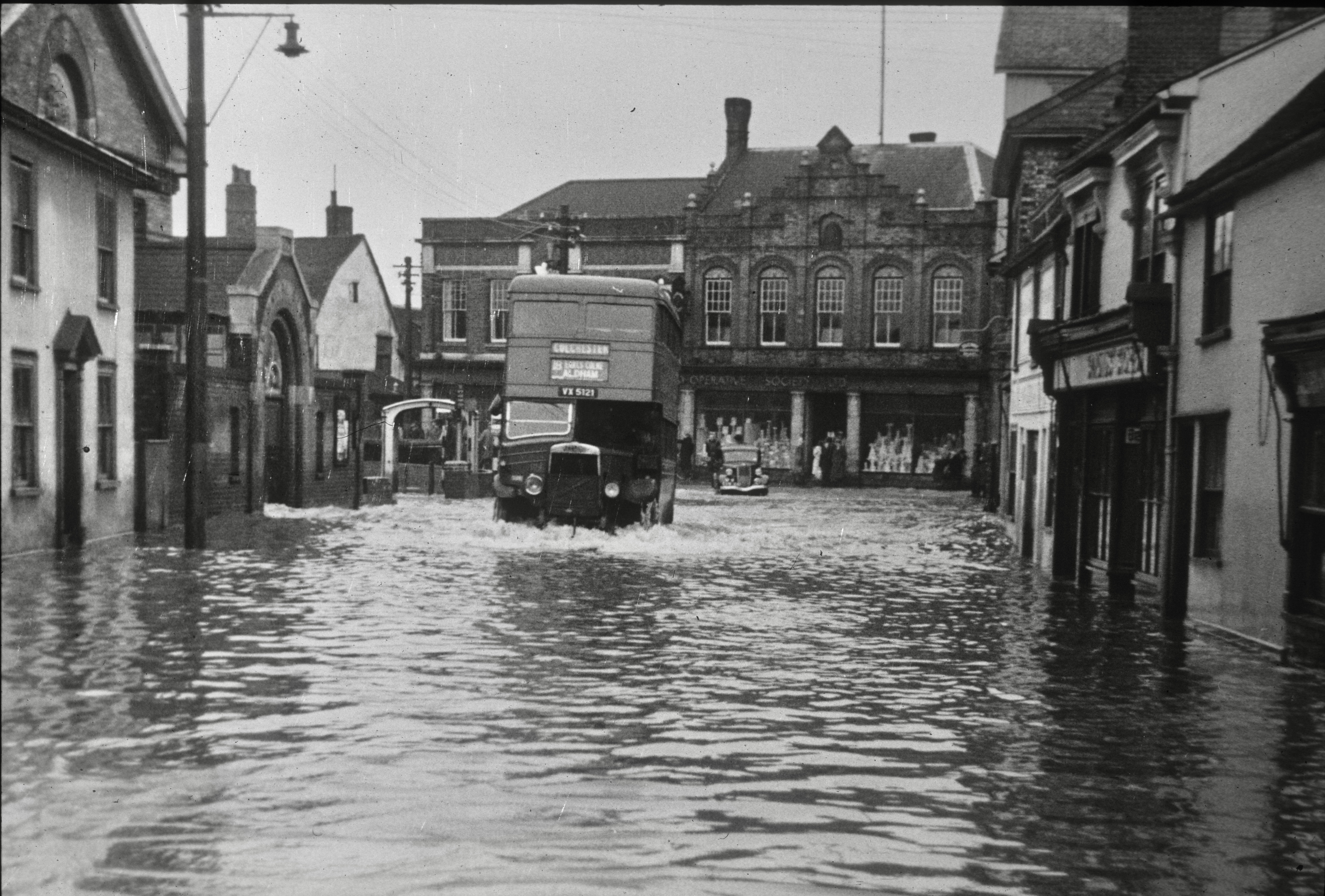
Like many settlements that have developed over centuries along the banks of a river, Halstead learned to harness its power and use it to its advantage. But with every advantage there is a disadvantage and the town’s position on the Colne’s floodplain has meant it’s always been vulnerable to the river bursting its banks. Being a resident since 1975 I can recall flooding in the late 70s and going back a little further, this image of Bridge Street, shows floods in 1947
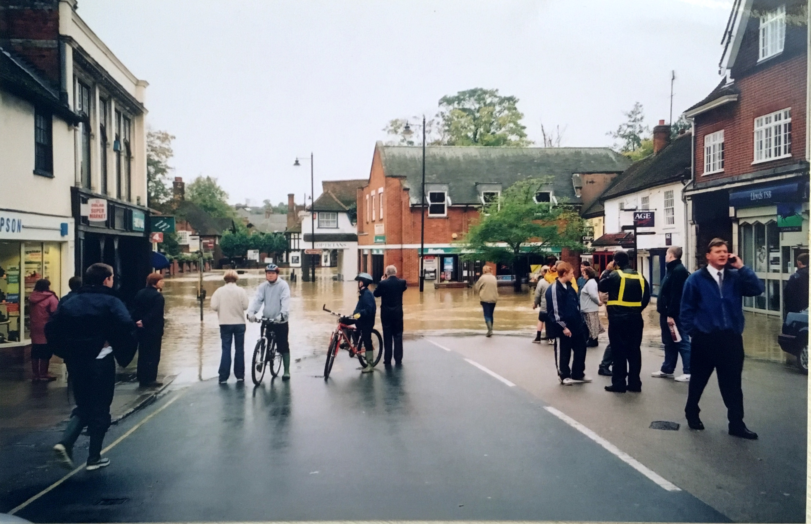
This month marks the 21st anniversary of the last major flood that struck Halstead. An average month’s rainfall fell in one day and River Colne burst its banks leading to floodwaters of up to 3 feet in the town, affecting residential, retail and industrial properties alike. Like many, I have vivid personal memories of this event, watching from my window as a ‘new’ river swept through the Co-op carpark carrying flowers, plants and pots from the flooded florist shop in the High Street and having to inform my parent that his car which was parked in said carpark overnight was now up to its wheel arches in flood water. We were lucky that that was the extent of personal damage suffered. Many were not so fortunate. This was the event that finally led to the River Colne Flood Defence scheme being created and which was completed in 2006.
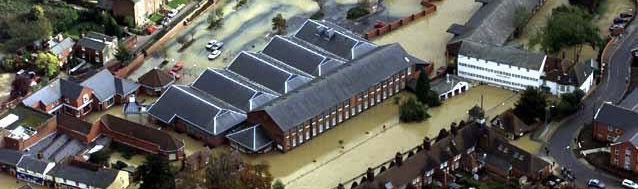
Aerial image of 2001 floods
Fast forward to December 2020 and North Essex was again subject to extreme weather, this time an unexpectedly heavy snowfall which thawed so rapidly the melt water rushed down the fields swelling the Colne and threatening Halstead once again. On this occasion the flood defences did their job and contained the waters in the “lake” created, slowing the flow and preventing flood waters reaching the town.
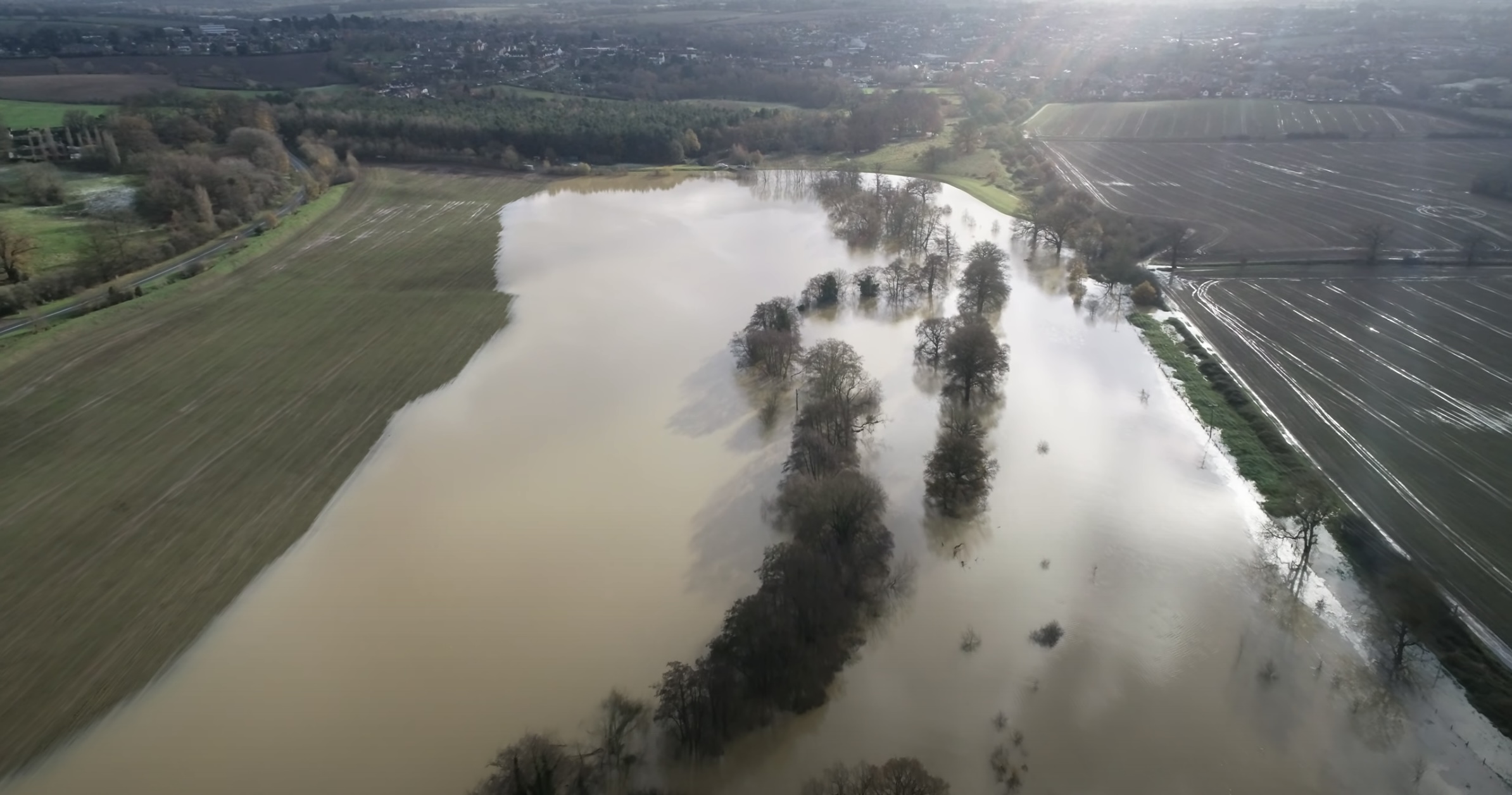
The image is taken from local resident Patrick Keeble’s amazing drone footage of the defences which can be viewed on YouTube.
In the intervening years there have been a few extreme weather events leading to localised flash flooding when the storm drains were swamped, mostly contained to the low lying, long suffering Bridge Street. However, these incidents which were once relatively rare have noticeably increased with the ongoing impact of climate change and what was once an infrequent occurrence seems now an annual if not biannual event.
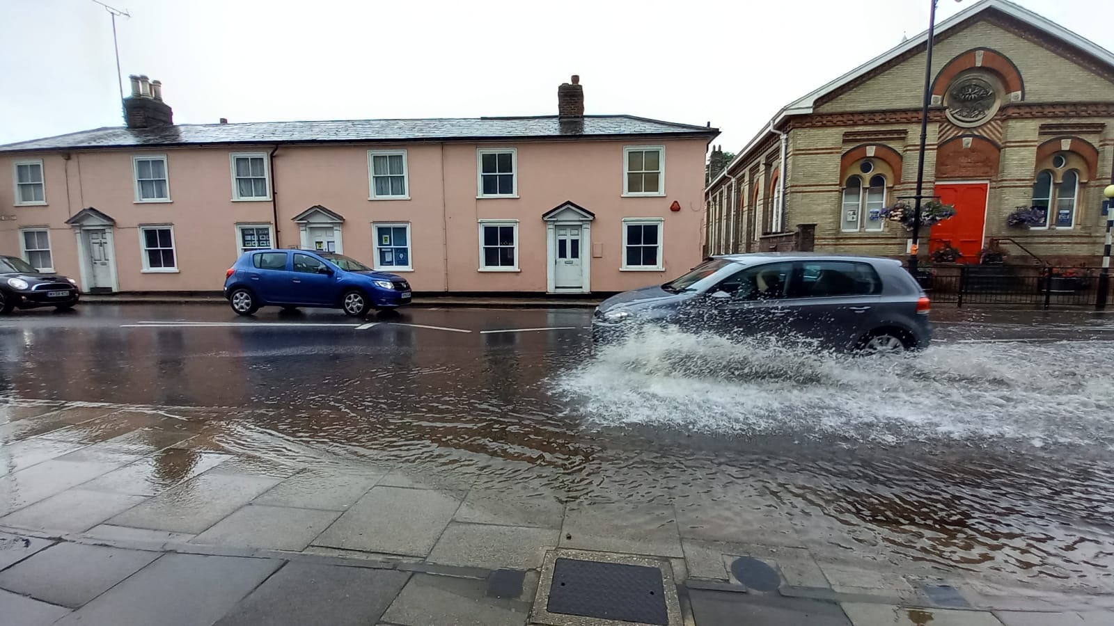
Bridge Street August 1st 2021
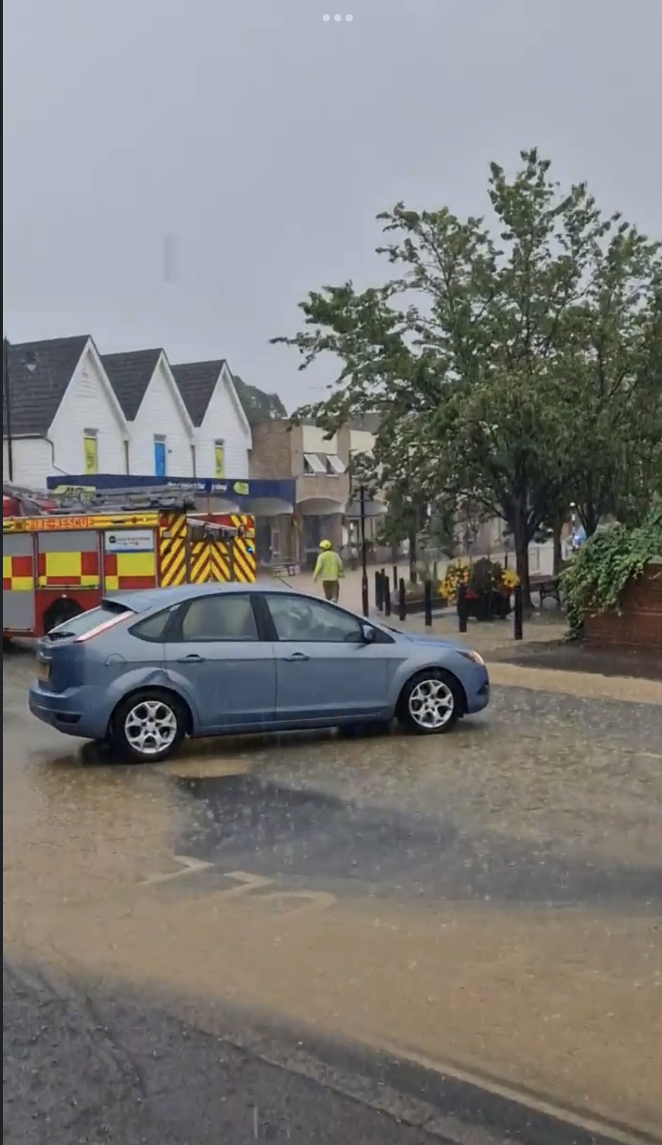 August this year, after the prolonged drought, the heavens finally opened and the concrete hard fields directed the deluge once again towards Bridge Street (and also Blue Bridge) Shops and offices were yet again flooded, despite the best efforts of the fire service which closed the road to traffic stopping the wash from exacerbating the situation. Image August 2022 by Danni Smith
The flood defences may save the town from the worst of the engorged Colne, but it can’t save us from overwhelmed drainage ditches, storm drains and sewers which cause significant surface water and flash flooding.
Will the loss of green space, cleared vegetation and trees, the increase in hard surfacing from paved-over gardens, combined with the development of new housing estates on the edges of our town, add to the pressure on our already strained drainage systems? It seems inevitable. Halstead is nestled in a valley so its low-lying centre will always be at risk as the water rushes downwards to the river.
If you have any memories or photos of the floods of 1947, 1970s and 2001, we'd love you to share them with us - just click here to message us.
© Halstead 21st Century Group 2026 Registered Charity No: 1180748
All images on this website contributed by H21stC Group members, Halstead Heritage Museum and Emily Hunn, unless otherwise stated.
Website by Phuse Media - Website Design Essex
Supported by


Follow us